
Farm Surveying and Soil Analysis

Technology we use
The technician is geared with a DGPS (Differential Global Positioning System) with a live satellite feed to survey and plot all features within borderlines and above ground.

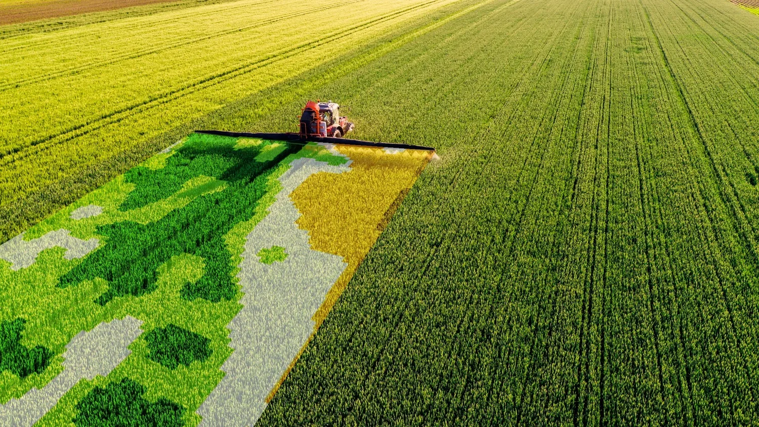
Soil Analysis
We identify and analyse the different soil elements and make the necessary allowances in order to effectively manage soil preparation for optimum production.

Farm Surveying
The correct calculation helps with cost effective fertiliser, seed and pesticide control inputs. Using a DGPS in WGS84 format all features, structures are surveyed and plotted.

Get a Quote
At Mapco we pride our self on our professional product and we strive to give the best support and service. Request a free quotation or contact us on 017 712 1075
Get To Know More About Mapco
Mapco has been up and running since 1989 and have done work in places like Zambia, Namibia, Angola and Mozambique. In 1998, we started making use of DGPS (Differential Global Positioning System) and in 2004 we began with precision soil analysis. Our head office is situated in Standerton, Mpumalanga with another office recently opening in Whiteriver, Mpumalanga and we’ve proudly opened a new branch in Montagu, Western Cape in February 2015.
Interested in working together? Fill out some info and we will be in touch shortly.